Voyageurs

Overview

Voyageurs, in far Northern Minnesota, is one of my unexpectedly favorite National Parks. 

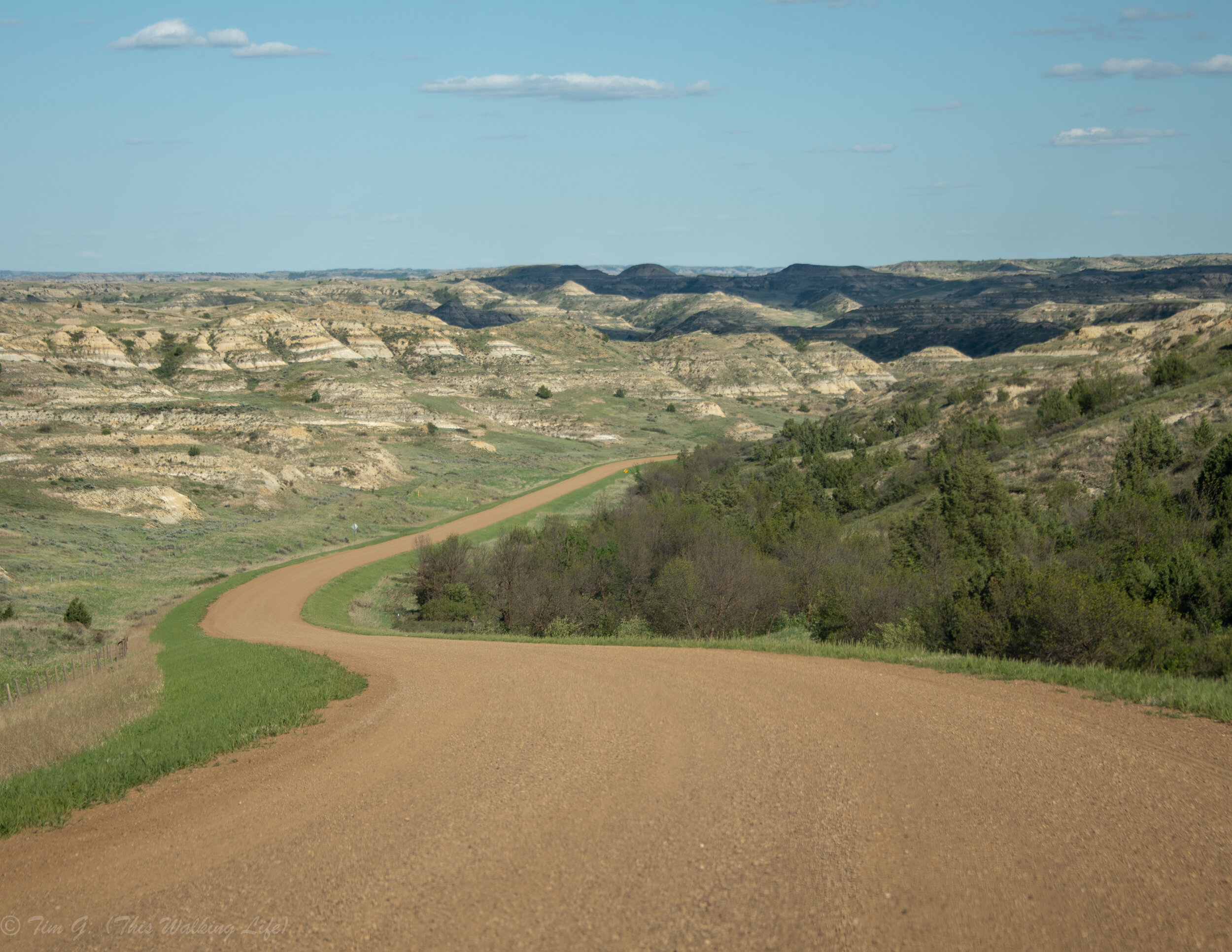
Why was I surprised? Well, I typically seek out places for extensive hiking trails, jagged mountain tops, and obvious dramatic views. Voyageurs has none of those things. It is a (mostly flat) water-based park. There are few maintained hiking trails, no mountains, 40% of its 218,200 acres are water, and 100% of its campsites require a kayak, canoe, or motor boat to access. 

And yet, because of these attributes Voyageurs offers a rare combination of self-directed adventure, beauty, wilderness and solitude. I cherish the hours I spent island hopping, napping under pine trees, watching gorgeously plumed birds fish, and floating lazily on the water. Moreover, because so much of Voyageurs is so far from any roads and its waterways naturally spread visitors out over its innumerable bays, beaches, islands, and forest glades (vs many of the other parks that funnel all visitors towards a few well-known sublime views) you are likely to find yourself all alone with pristine natural beauty and wildlife (in silence) often.

While no guide can give you a perfect path for exploring this wilderness oasis, below you’ll find suggestions that I hope will empower you to begin planning your own unique adventure, including tips on how to get to the park, when to go, activities to try, places to stay, and photography idea. 

DSC_9449.jpg


Getting There: How and When to Go

Voyageurs protects nearly a quarter million acres of lakes, islands, and forest land along the US-Canadian border in Minnesota.

The closest major cities to the park are Minneapolis, Minnesota (a 5 hour drive to the south) and Winnipeg, Canada (4 hours northwest). There is also a very small regional airport close to the entrance of the park in International Falls, Minnesota.

The park is open year-round. However, the most popular season for exploring is summer, especially from Memorial Day to Labor Day. Early fall can also be a nice time to visit the park, however weather can be dodgier. For the truly hardy of spirit the park remains open all winter. Snowmobiling and cross-country skiing are possible once the lake’s freeze solid. Winter is known also a great time to come up for star gazing and aurora borealis watching. It’s important to note that this part of Minnesota can get snowstorms as late as May and as early October, though typically icy waters and winter weather span November to April.    

Pro tip: summer weather may be perfect for humans, but be aware that it’s also perfect for mosquitos and flies too. If you are traveling in the summer, especially in June and July be sure to bring bug spray and a head net, especially if you are planning to camp. 

Also note that even on days when the temperature isn’t especially hot the sun can be quite intense as it reflects off the water. For those of you who are fair skinned (like me), make sure to bring plenty of sun protection, including a wide brimmed hat, a SPF shirt, and a buff for your neck.

DSC_9579.jpg

Navigating the Park

As you plan your visit, it’s important to remember there really isn’t very much to do that is accessible by car. Yes, there are a few very short hikes and exhibits worth seeing near the visitor centers (such as the Ellsworth Rock Gardens at Kabetogama); however, this is first and foremost a water park. You should make your plans in terms of which bodies of water you want to explore and how you want to get on the water.

There are four main access points into the park: Rainy Lake, Crane Lake, Kabetogama and Ash River.

Rainy Lake in International Falls serves the northern most portion park. Here you will find the park’s main visitor center, which is open year-round. 

The park’s northern boundary traverses 55 miles of the US-Canada border, much of it cutting through the middle of Rainy Lake itself. The lake is massive and extends beyond the National Park, with miles of snaking shorelines, some areas of development, and also hundreds of secluded uninhabited islands. Rainy Lake stretches deep into wilderness areas on both sides of US and Canada of the border. (Even with the closure of the border in 2020 due to Covid-19, there is still much to explore in this section of the park).

Crane Lake is technically just outside the park boundaries, but is the best place to access to the southeastern most portions of the park. 

Kabetogama and Ash River are between the two. Both are about a 45-minute drive south of the Rainy Lake Visitor Center and have seasonally open visitor centers. These are in the heart of the park, and have the best access to the most remote areas of the park’s protected wilderness.

DSC_9629.jpg

 Activities

Camping: the best way to enjoy Voyageurs is to get out into the wilderness and unwind over a multi-day period. From a campsite on the water you can really sink into the rhythms of nature, spending your days paddling, swimming, birding, chilling, camp-firing, rock scrambling, cliff jumping, island-hopping, forest bathing, sunset watching, and star gazing. 

The park service has set up numerous campsites throughout the park. Please note ALL are accessible by boat only.

In addition to paddler friendly campsites, there are also special moorings throughout the park for motor and houseboats, which can be rented and operated (without any special license). House boats help you explore further and enable you get deep into far corners of the park without ever giving up the comforts of a hotel. 

Campsites and houseboat moorings must be booked in advance and online 

Paddling and Island Hopping: Kayaks and canoes can be rented from many local resorts or guiding companies in the area, including Voyageurs Outfitters. Most outfitters offer both equipment only and guided options for both single day and multi-day adventures. Rentals are available from all four resort areas. Note that the most popular day kayaking routes are from Ash River; however, I also enjoyed kayaking around Rainy Lake in several spots.  

While planning is important before you head out on the water, my favorite memories are actually from the times I pulled ashore in completely unplanned, nondescript spots on a whim. I particularly cherished a nap I took under a grove of red pines one afternoon, and numerous explorations of trail-less forests and coastlines on small islands. 

For those who want to combine boating with established hiking, the park service also maintains a number of trails which are only accessible by boat. The easiest to get to is the 1.2 mile Black Bay Trail. It is a short paddle from the Rainy Lake marina. For the more adventurous, there are several longer trails further into the park’s wilderness including ones at Cruiser Lake, Locator Lake, and Beast Lake. 

Motor Boating: The most efficient way to explore large portions of the park is by motor boat. If you only have a day or two to explore, a guided motorboat tour is the way to go. Several companies offer highly rated tours, including Voyageurs Outfitters. Numerous outfitters also offer fishing tours.

On-Shore Hiking: There are very few front country hiking options. Of these, my favorite was the Blind Ash Bay Trail. The hike starts at Lake Kabetogoma Overlook parking area, and winds through a boreal forest ecosystem and along a ridge line that overlooks beautiful sections of water and the islands within it in several places. 

DSC_9202.jpg

 Hidden Gems:

The Kettle Falls Hotel is the only lodge technically inside the park. Getting there is part of the fun as it’s 16 miles from the nearest road. Thankfully, the hotel offers a boat shuttle from Ash River for guests. Whether you are staying at the hotel, or merely stopping by, it’s a fun plan to hang out, grab a meal, or play a game of pool. 

The Namakan Narrows is known for its especially good wildlife viewing, and for the way the shores of the US-Canada border converge in a number of places to only a stone’s throw apart. Unfortunately, they are most easily accessed from the Canadian side of the border which is closed in 2020. However, it can also be accessed by boat from the US side. 

Sand Point has some of the parks most beautiful campgrounds, including one on Burnt Island. Be on the look-out for local who can point you to the cliff jumping spots throughout the area. 

Lastly, Vermillion Gorge can be floated when the water is high. It is in Crane Lake, and accessible via boat and a hiking trail behind Voyagaire Lodge.  

DSC_9321.jpg

 Where to stay 

Camping: camping in the park requires advanced online reservations. As a reminder, all campsites require a boat to access. I found the rangers I spoke to extremely helpful at helping plan routes and campsites. For those looking to camp onshore there are some (rather limited) car-camping sites nearby-(ish) outside of the park boundaries. These include the Woodenfrog State Forest Campground near Katetogoma, the Ash River State Forest Campground, and also Dispersed Camping in the Superior National Forest.

Lodges: there is only one small rustic hotel in the park, the Kettle Falls Hotel. To get there requires a boat or sea plane. The hotel also offers a shuttle from the Ash River Visitor Center upon request. 

Resorts: There are also a number of rustic resorts nearby park’s southern entrances that primarily cater to families, including Voyaguers Sunrise Resort and Harmony Beach Resort (near the Kabetogoma Visitor Center), Sunset Resort and the Ash Ka Nam Lodge and Resort (near the Ash River Visitor Center), andVoyagaire Lodge and Voyageurs Landing Resort (on Crane Lake). Note that many of the resorts near the park haven’t optimized their Google keywords and Expedia strategies, so a simple google search is unlikely to yield results of all available resort options in the area. Use the links above to check availability on their websites as a first step in your search.

Hotels / Airbnbs: traditional motel and house rental options are a bit difficult to come by in northern Minnesota. Your best bet is to look for places in International Falls or the cute town of Ranier, which is near the Rainy Lake Visitor Center. 

DSC_9504.jpg

Photography Ideas

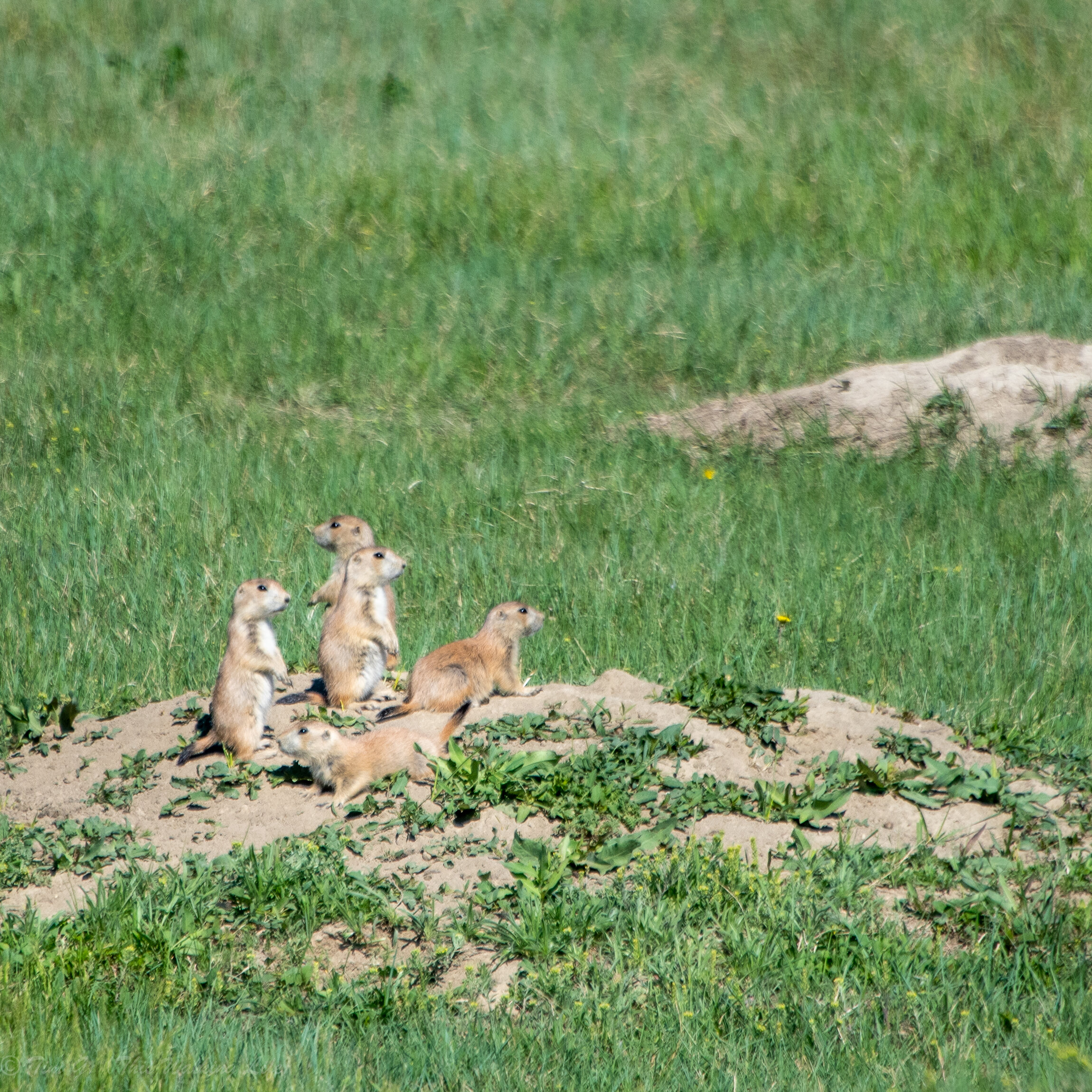
Consider bringing a telephoto lens to capture the details of the many large striking birds (including Trumpeter Swans, White Pelicans, Pileated Woodpeckers, Belted Kingfishers, and Bald Eagles to name a few) that calls this refuge home. Consider moving slowly through the forests to shoot the textures and colors of the bark and moss. And don’t forget to bring a tripod and wide-angle lens to capture both the movement and reflections on the waters and the colors of the sunrises and sunsets across it. 

DSC_9319.jpg

Conclusion

Voyageurs is unique in the park system. As you adventure within it, I wish you many moments of solitude, joy, and wonder.

As always, leave a comment below if you have any questions or suggestions on how to improve this guide.

Everglades

When you close your eyes and imagine the Everglades, you wouldn’t be alone if the first thing that came to mind were swamps and alligators. In a way you’d be right. It is full of both swamps and alligators. But you’d also be missing the bigger picture. The Everglades is actually one of the most diverse ecosystems in the world. And at its core is one massive slow-moving river – 60 miles wide and 100 miles long — which sustains not only myriad types of flora, but also numerous bird and animal species (including humans).

DSC_6793.jpg

The Everglades National Park was established in 1947 to protect over 1.5 million acres of this sub-tropical wonderland.

While the park’s edges are less than hour from the popular tourist destinations of both Miami and Naples, getting there is only a first step. Given its size and lack of significant hiking trails, many visitors feel overwhelmed when planning a visit. Instead of exploring on their own, they end up just booking a half day van tour from Miami. You can do better. To aid in your adventure, this guide includes an overview of each public area of the park, how to get there, specific touring ideas, and thoughts on where to stay. Happy adventuring!

DSC_6652.jpg

Navigating the Park

The Everglades National Park is massive and extremely diverse. Given this, figuring out what you want to see and how to get there in advance is important. This section of the guide provides an overview of each of the main areas of the park.

Source: NPS website

Source: NPS website

Shark Valley is home to the Everglade’s iconic sawgrass freshwater sloughs. Its views, easy alligator viewing, and proximity to the Miami (45 minutes without traffic) make this the most visited and easiest-to-get-to section of the park. 

To get oriented, I recommend taking the 2-hour tram tour that leaves from the Shark Valley Visitor Center ($27 for adults and $14 for children as of 2020). It’s a fun way to see different views, while learning about the Everglades from a trained naturalist guide. Alternatively, you can bike a portion (or all) of the scenic 15-mile loop road at your own pace. Don’t miss hiking up the Observation Tower midway through the loop for panoramic views of the sloughs in all directions. 

This section of the park is also known for its airboat tours, which let you zip through large swaths of the river of grass (as the Everglades is also known) and get close up to alligators in their natural habitat. (More on these tours in the next section of this guide).

DSC_6754.jpg

Everglades City (Gulf Coast Visitor Center): Here you’ll be greeted to entirely different views from Shark Valley. This section of the park protects the coastal estuaries where the freshwaters in the sloughs flow into the Gulf Coast. Expect to see beautiful cypress trees and mazes of mangrove forests throughout. Note that there are no roads or trails in this section of the park. Instead, you’ll have to get on the water if you want to explore. (Options for doing are included in the next section of this guide.)

DSC_6969.jpg

South Road (Royal Palm and Flamingo): accessed through Homestead, a single park road will take you through the last vestiges of hardwood forests near the park entrance, through freshwater marl prairies, cypresses, and coastal marshes, before leading you onto the beaches along southern tip of mainland Florida.

Without stops, this drive takes less than hour. However, I recommend going slowly, stopping at the pullouts, and walking all of the short platform hikes along the way.

DSC_6453.jpg

Confusingly, there are two visitor’s centers near the park entrance. The first is the Ernst Coe Visitor Center, which has a number of informational exhibits. Less than 10 minutes away is the Royal Palm Visitor Center. Stop at both, and make sure to walk the Anhinga trail at Royal Palm (0.8 miles round trip), where you are almost sure to see alligators amid the lily pads. 

Pro tip: This south section of the park is filled with hardcore bird watchers, many with powerful binoculars and scopes. As you drive toward Flamingo, you’ll often see them stopped along the road in seemingly random places. Do yourself a favor and stop to chat with them. They often have found beautiful birds hiding nearby that they’ll point out to you. 

DSC_6735.jpg

Finally, at the end of the road you’ll get to Flamingo Visitor Center, Marina, and Campground. While there, consider renting a kayak to paddle one of the “trails”, or book a motor boat tour. (More details on both options are included in the next section of this guide.)

Alternatively, Flamingo has the park’s only long (and very muddy) hike, the Coastal Prairie Trail.  

DSC_7035.jpg
DSC_7052.jpg

Marjory Stoneman Douglas Wilderness: this area of park between the Gulf Coast Visitor Center and Flamingo Visitor Center is a maze of tidal estuaries, filled with exotic wildlife and mangrove forests. It’s meant to be explored in days (not just an afternoon). To aid in your adventures, the park service has built dozens of backcountry campsites which can only be accessed by boat. (More on exploring this area of the park below.)

Source: official NPS map of sites between Flamingo and Gulf Coast Visitor Centers, see: https://www.nps.gov/ever/planyourvisit/wilderness-trip-planner.htm

Source: official NPS map of sites between Flamingo and Gulf Coast Visitor Centers, see: https://www.nps.gov/ever/planyourvisit/wilderness-trip-planner.htm

Planning Your Adventure Activities

While you can see some of the park from the road and viewing platforms, most of its wonders are far from them. So, in addition to a good pair of binoculars, I recommend you budget time to get into the tall grasses and tidal estuaries on an airboat, motorboat, or kayak as well. 

Airboats: Because the sloughs are massive, extremely shallow, filled with dangerous creatures, and covered in sensitive grasses, getting out into them can seem tricky. Walking isn’t possible, and traditional motorboats would get stuck. The solution is taking an airboat. These boats are flat-bottomed and propelled by a GIANT fan, which enables them to cover miles shallow waters in minutes and safely get you right next to the animals you want see.

There are numerous airboat tour companies. Some like, the Everglades Safari Park, have physical locations and on-land attractions for kids too. Others are merely a person with a boat who’ll take you out into the Everglades wherever he/she wants to go. To be honest, I don’t think you can go wrong either way. 

Pro tip: while many airboat tour companies geo-pin themselves as “inside the park” on Google Maps, few of them actually have physical locations at all, and many aren’t even allowed to operate inside the National Park itself. Instead, after booking online or on the phone, expect to meet someone at gas station near the park entrance, who will then direct you to an airboat parked in the water somewhere nearby. Once aboard you may (or may not), actually go inside the Everglades National Park boundary. Many tours end up in the sloughs to the north (technically the Everglades Wildlife Management Area). I’ve done both types of tours. They are both helpful for getting a sense of the ecosystem and getting up close to its many native species, including alligators.

DSC_6493.jpg

Motor Boats are a good way to explore the coastal areas near both Everglades City and Flamingo. In addition to general sightseeing tours, there are multiple types of specialty tours depending on your interests, from fishing, to dolphin viewing, to bird watching, and photography. (Use this link to browse the latest NPS authorized guide list.)

DSC_6469.jpg

Paddling: 

  • Day trips: while most National Parks boast about their hiking trails, the Everglades NP is known for its seven paddling “trails”, all situated near the Flamingo Visitor Center. Whether you are a beginner or quite advanced, the Park Service has done a nice job creating “trails” that accommodate all skills. No need to bring your own kayak either. Renting equipment is easy and cheap with Flamingo Adventures, who has a physical location right near the marina. Alternatively, you can also do kayaking from Gulf Coast Visitor Center (official paddling guide for this section of the park can be found here). There was no official outfitter from the NPS when I went for this section of the park, but multiple companies in the nearby area could deliver kayaks to you there, including Everglades Area Tours.   

  • Backcountry: a multi-day paddle would be a very special way to explore the Marjory Stoneman Douglas Wilderness. This area of the park is true wilderness, though the park service has helpfully built dozens of backcountry campsites (including a mix of on ground, beach, and elevated platform ones) throughout to facilitate exploration. Careful planning is required to navigate this section of the park. If this interests to you, check out the park service’s backcountry trip planner as a first step. Next, find a good outfitter or guiding company. While I haven’t made the trip yet myself, I had multiple conversations with Everglades Area Tours. They were very helpful, and talked me through all sorts of packages they offer, including equipment only, multi-day guided tours, shuttle services, and boat assisted base camps. 

DSC_6781.jpg


When to go

While I’m sure all seasons have their charms, try to plan your trip between November and March. This window is best for minimizing exposure to mosquitos and next-level humidity. Still, note it can be quite hot even in the winter months. Always bring plenty of water and sun protection, whenever you visit. Lastly, even in the dry season, bug repellant is a good idea, especially if you’re planning to be out near sunrise and sunset.   

DSC_6982.jpg


Where to Stay

Front Country Camping: there are only two front-country campground’s the Park. Both are in the south section. The Long Pine Campground is near the entrance to the park and the Flamingo Campground is at the end of the road. The Flamingo Campsite in particular is known for good stargazing as it’s very far from any city lights. You can reserve both RV and tents spots online through the Everglades Guest Services.

If you are hoping to stay near Shark Valley or Everglades City, additional camping is available outside the National Park in one of the Big Cypress National Preserve’s 7 campgrounds.

Hotels: Being so close to Miami it’s easy to find hotels for all budgets if you’re planning a day trip into the park. This is a good jumping off point whether you plan to explore Shark Valley or Flamingo. However, if you have an early morning boat tour (or want to stay out late) near Gulf Coast Visitor, hotel availability is low (and costs are high!) around there. Book a spot a month + ahead during busy season to find the best deals. While there are some motels in the small towns near the Gulf Coast Visitor Center, the closest major areas with large numbers of hotels are Marco Island and Naples.  

DSC_6956.jpg

Personal Reflection

I loved my time in the Everglades, especially the areas in the south of the park. Something about the environment made time slow down for me. Perhaps it was the lack of mountains to climb vs. other parks, but the flat trails and easy paddles brought me into a place of deep peacefulness and observation. For instance, I’m not a “birder”, but I sat perfectly content for hours watching various birds in the park. When I close my eyes I can still clearly see the egrets “dancing” on the water as they tried to woo a mate, ibises and spoonbills swooping in and out of cypress boughs, anhingas preening, and an osprey emerging from the lake with a snake in its talons.

DSC_7134.jpg

Even though I know these sights were signs of the dance of life and death always happening in the Everglades, being with it in this way, so far from cell service or other distractions, and with nothing to do but watch, brought to me a place of deep stillness and contentment.

Later, I would learn the ecosystem itself has been undergoing slow deadly pressures on a different scale altogether. These learnings shook me from my state of peaceful contemplation into more intense emotions.

Every tour guide, local, and park ranger I met who’d been in Florida more than 20 years wanted to tell me about “the shrinking” and “slow death” of the Everglades. I heard countless stories about how Americans have dredged, pumped, dammed, and tried to fill in large swaths of the Everglades over the last two centuries.

This type of destruction is not only an ancient phenomenon. Nearby agriculture, urban development, toxic dumping, and climate change all continue to contribute to the shrinking and damaging of numerous areas within the park boundaries.

Listing all of the environmental degradations done to the Everglades could fill up pages of this guide, but one recent story really jumped out to me. Since the 1990s, there has been a proliferation of dangerous predatory invasive species through the park. This includes hundreds of thousands of 20+ foot Burmese Pythons (!), who escaped from locals homes and pet stores. Today, those pythons have bred beyond the point of control, and have become a danger not only to all all sorts of bird species, but even to alligators and humans too.

DSC_6516-2.jpg

Despite our mixed record of stewardship of the Everglades, the ecosystem remains essential to human habitation of South Florida. Without its fresh water sloughs, which fill up aquifers, it would cost a fortune to transport enough water to support the millions of people and density of water intensive agriculture in South Florida. Despite this, actually getting the political will protect the ecosystem has been a constant battle. Pressure for development close to the park’s eastern edge remains intense. Poisonous levels of mercury and fertilizer run-off are recorded annually in many sections of the park. And rising sea levels threaten ever larger sections of the coastal habitat. Meanwhile, in a strange reversal of history, billions of dollars have been spent on artificial pumps, passages, and dams in recent years not to drain the Everglades (like in times past), but in an attempt to keep the freshwater sloughs on “life support” (as one guide tartly told me.)

As a country we give a lot of lip service to protecting our wild and beautiful places. And, part of that is undoubtedly true. We have protected millions of acres of land from development. However, the history and trajectory of the Everglades also shows me that too often it’s also become the excuse to allow other forms of reckless development and environmental mismanagement elsewhere. Sometimes, it’s easy to not even notice. However, in the case of the Everglades, our collective unwillingness over decades to deal responsibly with these the complicated tradeoffs between development and preservation may ultimately destroy large portions / all of the lands “protected” within the park, and will have untold economic costs on the millions of people who live in the lands nearby it.

DSC_6676.jpg

Conclusion

Thank you for reading my National Park Adventure Guide to Everglades National Park. I hope you have a wonderful time exploring. 

As always, if have any comments or suggestions on how to make this guide better for the next reader write them below or contact me directly.

Close up of an alligator’s tail through the tail grasses. Like all the best moments in the park, this was a total surprise. I’d been standing nearby for a long time completely oblivious to the gator’s presence. Another reminder for me to slow down a…

Close up of an alligator’s tail through the tail grasses. Like all the best moments in the park, this was a total surprise. I’d been standing nearby for a long time completely oblivious to the gator’s presence. Another reminder for me to slow down and really see what’s before me.

Biscayne

Biscayne National Park is an oasis of calm coast lines, protected bays, and tropical islands in South Florida. Known as America’s first marine park, it was established in 1968 to preserve several of the northernmost Florida Keys and the fragile aquatic ecosystems which surround them.  

In order to appreciate it you need to get out on the water. Luckily, there are many ways to do so – from scenic boat rides and fishing expeditions to dive trips and sail boats. No matter which way you choose to explore the park, you are sure to experience something very rare – tropical wilderness, only an hour from Miami.

Ornamental lighthouse on Boca Chita Key

Getting Oriented

While you can drive to the parks’ Dante Fascell Visitor Center, there isn’t much to see there. Instead, your adventures will begin when you board a boat in the visitor center’s marina and get out into the bay. From there, most visitors head to one of the park’s three main protected islands: Elliott Key, Adams Key, or Boca Chita Key. Each have unique histories and draws.

BISCmap1.jpg

Elliott Key is the largest island in the park. It is seven miles long and 2500 feet wide. The island has been home to pineapple plantations, Tequesta Indians, pirates and escaped slaves at different points in its history. 

Dramatic changes seemed to be coming to the island in the 1950s and 1960s when plans were made to connect it to the mainland by building a series of roads, bridges, and causeways. In their wake, ports and hotels were planned, which would have required clearing most of the land on the island and dredging up a 40-foot deep passage through the bay between it and the mainland. Expecting riches would follow the building of the road, 13 of the island’s 18 registered voters voted to incorporate the new city of Islandia in 1960 in order to give themselves more control over the island and it’s expected coming development. 

At the same time, over the 1950s and 1960s a wide coalition of local and national figures banded together to advocate for the creation of a National Park in the area as a way to halt development and protect the unique wildlife habitats in the bay. Tensions between those in favor and those opposed to establishing a National Park grew very heated and personal. Those opposed to the park argued that development (vs. preservation) stifled their freedom and prevented the creation of good jobs.  

Stories abound of personal feuds and dirty tricks between the two sides. Some of the most extreme examples include one opponent of the park poisoning someone’s dog, and the secret nighttime bulldozing a 6-mile long, 6 lane wide strip through the center of the island. This scar through the landscape would later become known as the “spite highway,” even though it never become a road for cars.

Despite all the acrimony, the broad coalition of supporters, led by local congressman Dante Fascell, ultimately convinced the federal government to protect the area in 1968. Afterward, all plans for roads and deep-water ports on the island were halted.

Over time, the park service acquired the individual properties on the island parcel by parcel. Finally, with no one left on the island, the town of Islandia was officially disbanded in 2012. 

Today, visitors can camp and picnic along the shore of Elliott Key. Or, if you’re looking for an adventure, you hike the spite highway from one end of the island to the other. 

Adams Key is much smaller than Elliott Key. Once it was home to the swanky Coco Lobo Cay Club, a private club for the rich and famous. Tycoons, senators, and even five presidents visited it during its heyday. Sadly, no signs of the club remain today. The main clubhouse was burned down in 1974, and Hurricane Andrew destroyed the remaining structures in 1992. Today, visitors can enjoy the island as a particularly serene picnic spot. It is open to tourists for day use only. 

Boca Chita Key is the most visited island in the park. Industrialist Mark Honeywell built a party complex on the island in the 1930s. While much of what he is built is no longer standing, the iconic lighthouse and several smaller structures are still there. Today, visitors can picnic, camp, and rest in the beautiful harbor he constructed. 

DSC_6884.jpg

How to Explore

The NPS has multiple guided boat tours leaving every day from the Dante Fascell Visitor Center. These tours take visitors on a number of different adventures, including separate half-day trips to each of the three major islands within the park. While these half-day tours are the most common way to explore, there are plenty of other tours available and worth checking out if you have the time and budget. 

NPS Eco-tours: The NPS also offers full-day snorkeling, sailing, and kayaking tours. Not every tour is offered every day. So, depending on what type of activity you want to do that may impact when you want to visit. Click on the link above to find out the latest schedule, which changes both seasonally and week-to-week. 

Private Tours: Unlike some national parks which exclude external guiding companies, numerous private tour companies are authorized to operate within Biscayne. The latest list of guides and activities can be found on the bottom of this page. As of February 2020, listed options included salt water fishing, snorkeling, scuba diving, sailing, speed boating, and aerial tours.

Hiking: There is very little hiking available in Biscayne National Park. The only significant trail in the park is the previously mentioned “spite highway” on Elliott Key. Otherwise, there is a short trail to the end of a jetty near the visitor center, and very short paths near the campgrounds on both Elliott and Boca Chita Keys.  

DSC_6927.jpg

Where to Stay

There are two campgrounds in the park, one of Elliott Key and Boca Chita Key. If you know someone with a boat, they can dock at either campsite for $25 per night. Otherwise, call the visitor center in advance to get permission to take your gear onto one of daily tours to and from the islands. 

“Onshore” camping is available in Everglades National Park (45 minutes away). Long Pine is the closest campground.  

Lastly, if you’re looking for indoor lodging, the park’s close proximity to Miami and Key Largo will give you myriad hotel options for any budget. 

DSC_6900.jpg

Personal Reflection

The establishment of Biscayne National Park was not easy. To overcome fierce opposition advocates had to work for decades, building support from a coalition that included diverse locals, fishermen, writers, national environmental groups, and millionaire industrialists living in faraway states. The compromises and promises made to secure the parks’ creation are part of the reason private tour companies and commercial fishing both continue to operate within the park today.

Much has been saved because of this coalition’s work 50+ years ago. However, even though the park was created, significant damage has also been done to the area since then. Moreover, continued risks to the environment remain.

For instance, while the fight to preserve the park was raging, a large swath of land directly next to it was developed into the Turkey Point Nuclear Power Plant. More than just an eyesore, the plant has caused numerous problems for the environment, including the discharge of millions of gallons of sea-life killing heated water directly into the ocean. While this issue has been resolved, the nuclear reactor remains controversial over concerns about its water usage and the increasing risk of accidents due to rising sea levels. Secondly, nearby Miami and its suburbs have swelled by more than 5 million people since the park was established. Its growth (along with certain agricultural practices) has accelerated the contamination and destruction of the Everglades. Historically, fresh water from the Everglades drained into Biscayne Aquifer which has been the main source of clean water for both humans and coastal wildlife. Unbridled development is threatening access to this clear water. Lastly, pollution runoff, trash (including micro plastics), and global warming are irrevocably changing the bay’s underwater ecosystems and shrinking its reefs.

Together, these facts are an important reminder that simply creating a park won’t save sensitive places forever. Ecosystems are interconnected, and the work of preservation must extend beyond park boundaries. To date, it’s been hard to get the political will to deal with these threats.

Knowing this history has shaken me from having any idealism about today’s conversation efforts. There is no “of course” that we as a country will protect our most beautiful, sensitive, or wild places. The reality is conservation work will always be hard fought, is never over, and involves tradeoffs, including addressing the real economic “pain” many locals feel when development is halted.

Seeing this more nuanced reality through the history of Biscayne is important as we consider what to do about demands for drilling, mining, and other forms of development today in wild places as diverse as northern Minnesota, southern Utah, and throughout the Alaskan wilderness.

View of downtown Miami from the Northside of Boca Chita Key

Conclusion

Thank you for reading my National Park Adventure Guide to Biscayne National Park. I hope you have a wonderful time exploring. 

As always, if have any comments or suggestions write them below or contact me directly.

DSC_6930.jpg

Dry Tortugas

Dry Tortuga

68 miles away from Key West, in the middle of the Gulf Mexico, is one of the most remote, least known, (and I think coolest) National Parks in the United States, the Dry Tortugas

Encompassing a small group of islands and reefs at the very end of the Florida Keys, the park is known for its tropical beauty (including some of the healthiest coral reefs in the US) and for its historical significance as the home to Fort Jefferson, one of the largest army forts / prisons ever built (but never finished) in the United States. 

DSC_7445-Pano.jpg

How to get there

Unlike most national parks, you can’t simply show up without plans or drive to the park. Getting there requires advanced planning and special transportation. 

Ferry: The Yankee Freedom (based out of Key West, FL) is how nearly all visitors see The Dry Tortugas. It’s a full day experience, starting with breakfast on the boat, and getting you back in time for dinner. Traveling to and from the island takes a little over 2 hours each way. Once there, you are given lunch and a few hours to explore at your leisure.

Pro Tips: The Yankee Freedom has a near monopoly on travel to and from the Park, and not surprisingly that means getting there is both expensive and difficult. Boat tickets cost $180 per person, including your national park fees (as of 2020). Figuring out parking adds to the cost. During high season spots on the boat should be booked months (literally) in advance (the lack of availability was a real surprise and near disaster for a last-minute traveler like me). Despite that, the boat is comfortable, and the staff is friendly, knowledgeable, and helpful. Lastly, be aware that the seas can be quite rough and the boat almost never cancels for weather reasons (according to locals I talked to). So, it’s on you to check weather forecasts, and make sure you are prepared if you’re apt to get motion sickness. To be honest, if the seas are going to be rough and it’s going to be raining, I would ask for a refund. If it’s going to be sunny and you can handle some motion in the ocean, push ahead.

DSC_7420.jpg

Sea Plane: A few companies take visitors out to the islands daily. Going by plane is quicker (typically takes 45 minutes each way), more private (4 people per plane vs. 200 on the ferry), but costs almost twice as much per person. If you’ve got the dough and photography is important to you, going by seaplane would be a great way to get aerial shots of both the reefs and Fort Washington. 

DSC_7543.jpg

Private Charter: Lastly, private fishing and scuba charters also take visitors out to the islands (typically on multiday trips). 

Pro tip: According to locals and park rangers I spoke to, the best months to visit the park are February – April. October – January can also be quite nice. However, while the waters can be calm during these months, visitors must be prepared for stronger winds and choppy seas on many days.

Exploring the Park:

Walking: Before I started my journey, when I thought of National Parks I imagined they all must have miles and miles of wilderness hiking trails. The Dry Tortugas doesn’t have any trails. In fact, except for the Pier and two small swimming beaches, it’s mostly covered by the MASSIVE hexagonal Fort Jefferson. (The only “wild” area within walking distance is Bush Key, however it is closed most of the year for nesting birds). 

When I first learned about the lack of trails I was disappointed. That was unnecessary, as it turns out. Climbing around and exploring the 16 million brick structure was a blast. In addition to walking parts of the ring around the moat (a must!), I loved hiking through and over the many stories of exposed masonry. 

DSC_7678.jpg

If you are a history or architecture buff, there is plenty to keep you occupied as well. Most interesting to me was seeing the prison cell that once held Samuel Mudd, who was convicted in the conspiracy to kill Abraham Lincoln. (He was later freed after helping to fight a deadly epidemic on the island). I also had an interesting conversation with a ranger about how refugees from Cuba in the 1990s often piloted to the island to claim sanctuary, and how during one of the recent government shutdowns a flotilla of residents from Key West boated out to the Island and illegally entered the fort in order to keep it open for tourists after all the park rangers left.  

DSC_7486.jpg

Snorkeling: I swam around nearly the entire island, slowly taking in the colorful fish and corals. I’d only recommend doing so if you are a strong swimmer. For less of an adventure, you could just snorkel near either the North or South Beaches. Personally, I thought the best snorkeling was around the North Coaling Dock Ruins. 

Pro tip: the quality of snorkeling depends on the surf. On a windy day visibility can be quite low. On clear days, the park is said to have some of the best snorkeling in the US. Unfortunately, the day I was there was windy. Even still, I loved my time in the water. It’s just another reason I need to plan my next trip out there. 

DSC_7605.jpg

Bird Watching: The Dry Tortugas are a stop for many migratory birds. Around 300 bird species pass through these tiny islands each year, some quite rare. On my trip, a few birders brought high powered binoculars and scopes up to the top level of the Fort Jefferson to observe nesting birds on nearby Bush Key. 

Even if you aren’t a birder, you can’t miss the spectacular frigate birds, who look like pre-historic dinosaurs, have 7-foot wingspans, and soar all day above the Fort.   

Hanging Out: the truth is most visitors do an hour guided tour of Fort Jefferson (led by the boat staff) and then hang out for hours on the beach. I didn’t do that, but people who did seemed pretty happy about it. 

DSC_7529.jpg
DSC_7551.jpg

Photography 

I imagine the best photography opportunities are available to those who camp overnight. Being so far out in the middle of the Gulf of Mexico you must get spectacular sunrises, sunsets, and stars. (More on camping on the island below). 

Unfortunately, from a photography perspective, most visitors only get to explore the island during the middle of the day (with all its bright light and glare). One way to deal this with is to get a polarized filter for your lens if you are shooting with a DLSR. This essentially lets you see the world through your camera as you do from polarized sunglasses. The filter lets you capture layers and colors (especially in the ocean) that usually get washed out on a bright day. 

DSC_7593.jpg

In addition to photographing the ocean and the beach, I really enjoyed shooting both around the moat and inside the fort. There are countless passages, nooks, layers, and broken bricks in the masonry that make for interesting compositions. Be sure to explore the middle level, not just the ground and the top, as most tourists do.

DSC_7752.jpg

Lastly, this would be a fun place play with underwater photography. I can imagine some really cool shots in the water with fish underneath and someone walking on the moat above. Unfortunately, capturing that kind of shot requires very fancy cameras or casings for your DSLR, which can run into thousands of dollars. Still, if you don’t have that kind of gear (which I don’t), it could also be fun to shoot some of the corals using a much, much cheap point and shoot waterproofed camera, such as the Olympus Tough TG-6


Where to Stay

In the Park: There is no lodging for tourists on The Dry Tortugas except for 8 primitive camp sites in the Garden Key Campground. Spots are available on a first come first served basis. 

Unfortunately, unless you have a private vessel, you’ll need to get a separate camping reservation from Yankee Freedom, which limits itself to bringing 10 campers each way per day. These restrictions mean if you want to camp, you need to book your reservation even further in advance than you would for a regular day trip (meaning many MONTHS or even a full year in advance during high season). 

From conversations with a ranger out on the island, usually there are only a handful (at most) of campers on the island each night, meaning once the ferry leaves at 3pm, you (and a handful of new friends) have the island essentially to yourself until 10am the next morning when the ferry returns. For Jefferson remains open until sunset, and reopens at sunrise.

Note that there is NO water or food available on the island, so campers need to bring all of their gear and supplies with them.  

DSC_7857.jpg

Onshore: When planning a trip to Dry Tortugas you’ll need to figure out lodgings onshore before and after your trip as well, since the ferry leaves early in the morning (you need to be there by 7am) and doesn’t arrive back to shore in the evening (usually after 5). 

This was a major annoyance for me. Key West is extremely expensive, especially during certain weeks in the winter, and you have to travel literally hours north before you can find cheaper lodging options. Given this, I’d recommend booking hotels a month + in advance in order to ensure you find a good deal. Otherwise, if you are a last-minute traveler looking for a good deal, like me, set that alarm for the middle of the night, and get excited for several hour pre-dawn drive through blackness before you catch the ferry.  

Pro tip: don’t let yourself get crabby about the lodging challenges of Key West (like I did), you’re about to be out in paradise

DSC_7567.jpg

There’s no denying it, it’s not easy to get to The Dry Tortugas, but remember as you make the journey it’s all part of the adventure. The day I went, as we were heading back to shore I took a look around the main cabin of Yankee Freedom and saw everyone was either smiling or fast asleep. It’s hard to have a bad day out there if it’s sunny…

DSC_7815.jpg

~~~ 

Thank you for reading my National Park Adventure Guide to Dry Tortugas National Park. I hope you have a wonderful time exploring.

Please subscribe below so I can let you know when my National Parks guide book is complete and available for sale. And, as always, if have any comments or suggestions for making this guide even more useful for the next reader please add a comment to this post or send me an email at tim@thiswalkinglife.com . 

DSC_7894.jpg

Wind Cave

Wind Cave National Park in South Dakota is home to one the largest cave systems in the world. The caves, named because of the way air rushes in and out of the natural openings with so much force it can blow a hat off your head like a giant gust of wind, stretch (at least) 100 miles underground. Inside, the visitor is greeted with gorgeous caverns filled with Boxwork Calcite (found almost no one elsewhere in the world). Unfortunately, due to both ongoing elevator repairs and Covid-19 social distancing requirements, the caves are temporarily closed to tourists in 2020. Despite this, the park is still worth visiting. I really enjoyed hiking above ground near lots of wildlife and through pristine mix-grass prairies.

DSC_1507-2.jpg


How to Explore

The cave can be explored through a variety of Ranger led tours (when the cave is open). Check the official park website for tour times and reservation details. (Personal note: while I didn't get to go into the cave in 2020 as part of my National Parks adventure, I have been in the cave before as a child, and hope to return someday soon to see it again as an adult.)

Above ground, I enjoyed hiking out on the Centennial Trail and looping back on the Lookout Point Trail. This formed a 5-mile loop. Going this way will give you a good overview of park, including leading you past several meandering streams, through tall pines, and across rolling prairies. Be on the lookout for wildlife throughout. In addition to bison, which could cross your path at any time, you’ll pass through two large prairie dog towns, and a number of spots with significant nesting bird populations. The prairie dogs are a particular joy to watch.

Pro tip: when you enter a prairie dog town you will be greeted by dozens of dogs screaming to each other in a seemingness endless chorus. As long as you keep moving that will continue. Instead, if you sit still for a long time the prairie dogs will eventually calm down and some may even approach you for a closer look. Separately, while there, don’t get too close to their holes. I say this out of respect for them, and also out of care for your well being. Once off the path, you are more likely to run into Prairie Rattlesnakes, who also enjoy prairie dog towns.

DSC_1376.jpg


Photography

Photography in the cave is likely difficult as both tripods and flash photography are prohibited. However, plenty of photo opportunities exist above ground. In addition to plentiful wildlife, I really enjoyed shooting the contours and colors of the landscape. 

DSC_1384.jpg

Also, don’t forget to look at your feet as you walk. This area of the Black Hills is filled with beautiful rocks, including lots of rose quartz. While it’s tempting to grab a piece, always leave no trace, and only take photos. 

DSC_1472.jpg


Where to Stay

There is one small (61 site) established campground in the park, Elk Mountain. Sites are reserved on a first come served basis. In addition, backcountry camping is permitted in the northwestern part of the park. A free permit can be picked up in the visitor center.

DSC_1464.jpg

There are several established campgrounds outside the park to check out as well, including several in Custer State Park as well as KOA sites in both Hot Springs and Mount Rushmore

If you are looking for a motel or a lodge, the closest town to Wind Cave is Hot Springs. There are some cool things to do in town, but to be honest I wouldn’t choose to stay there on a future trip for more than one night. Instead, consider setting up a basecamp in the town of Custer or one of the lodges in Custer State Park.  

DSC_1264.jpg


Nearby Places to Explore

10 minutes to the south of park entrance is the town of Hot Springs. I got a kick out of the Mammoth Site in Hot Springs, which is an active archeological dig (indoors) containing at least 1,200 mammoth bones. The site was discovered by a developer in the 1970s who was bulldozing a hill in order to make apartments. Can you imagine what he thought when he first found all those giant bones? If you are traveling with kids, in July and August the museum offers a Junior Paleontologist program for them to participate in “digging”.

30 minutes to the north is the entrance to Custer State Park and the beautiful Pinnacles Highway.  Highlights of the park for me included Slyvan Lake, which is a great place to swim and stay (there is both a lodge and a campground there). The park also has several half day mountain hikes I really enjoyed, including Black Elk Peak and Little Devil’s Tower. 

Continuing North, you’ll arrive at Mount Rushmore, which needs no introduction, and an hour and half past there is the town of Spearfish. Hiking up to the Spearfish Falls is easy and beautiful. If you want more of a challenge you can extend the hike further to see two additional falls. 

30 minutes west is Jewell Cave National Monument. Unfortunately, like Wind Cave, the cave itself is closed in 2020 due to Covid-19. Hopefully by the time you are reading this guide it is open again. 

Beyond Jewell, continuing onward into Wyoming, is Devil’s Tower National Monument, a strange geological feature, rising 867 feet straight up out of the prairies. The Tower has long been sacred for many Native Tribes, and is also famous in current popular culture today for many reasons, including for its role in the final scene of Steven Spielberg’s Close Encounters of the Third Kind

DSC_1023.jpg

Lastly, while in the area make sure to at least drive through the Badlands National Park. (For detailed recommendations on visiting the Badlands check out my guide: here.)


Personal Reflection

As part of my project, it’s been important to me to photograph each park in a way that captures something “essential” about it. Therefore, for a park with the name “Cave” in the title, it seemed obvious to me that I needed to photograph inside the cave.

Unfortunately, before going to South Dakota, I read on the official website that the cave was closed. Should I even go if I can’t photograph what I want I wondered? After debating it for a while, I grudgingly decided to go for a few reasons. Firstly, I’d already be in the area so it wouldn’t be that inconvenient. Second, it’d be hard to return anytime soon. Third, during the first weeks of June 2020 a lot of parks that had been closed for months were beginning to open up each day. Maybe, once I got there things would miraculously open there too.  

Upon getting to the park, I headed to the visitor’s center, hoping a ranger would tell me something encouraging. Unfortunately, not only was it closed but I couldn’t find any rangers. Despite that, I got out of my car to see if I could find any more information. Sure enough, taped to the door was a typed sign (in small font) letting people know the cave was indeed still closed. As an addendum, the note added that the rangers had no idea when the cave would open again. It wasn’t just Covid-19 and the impossibility of letting people into the “small” and “confined” spaces while social distancing was necessary. No, more fundamentally, the elevator down had broken in 2019 and they “didn’t know” how long, or maybe even “how”, to fix it.

I know that on an adventure it’s almost guaranteed things will not go according to plan. But sometimes, it’s still hard for me not to be mad about it at first.

Unable to go in the cave, I decided to try to make the best of it, and instead just explore above ground for a day instead.

I’m so thankful I did. Freed of any time pressure or need to capture “the essence” of the park, I simply walked by myself and explored at a leisurely pace without real plan or purpose.

While on the trail, I sat beside a stream in the shade for a while. Later, I discovered what looked like a cave entrance up in some nearby cliffs. Upon getting closer, I saw literally thousands of swallows flying in and out of it as they tended to their nests in the rocks. (In the picture below you can see their nests and heads popping out of many of the nests).

DSC_1290.jpg

Later, I sat for over an hour in the midst of a prairie dog town, watching and listening to the creatures investigate me, care for their young, and play with each other.  

DSC_1450.jpg

The truth is, I wouldn’t have seen any of this had the cave had been open. Or even if I had, I probably would have been in a hurry (or too tired) to slowly take it in the way I did. 

The experience was a good reminder to me to have equanimity when things don’t go accordingly to plan. Of course I was disappointed and frustrated. Obviously, I don’t get the cave photographs which are important to the project I’m working on. However, because things didn’t go according to plan I also got to experience a lot of unexpected joy and beauty too. 

DSC_1485-Pano.jpg

I hope you have a wonderful time at Wind Cave National Park (and that the cave opens up soon too). As you read this and explore the park for yourself, please let me know if you have any suggestions on how to make it even more useful for others. Until then, happy exploring!

Badlands

When approaching the Badlands you are given no foreshadowing of what you are about to see. Without warning, the seemingly endless Dakotan fields and prairies disappear, replaced by a treeless Martian landscape of labyrinthian ravines, jagged ridges, and vividly colored rock spires. 

DSC_2476.jpg

The contrast between the flat, lush fields outside the park and the craggy desolation inside the park can be jarring. Rather than rushing ahead, I recommend pausing to sit with the park’s strangeness when you first arrive. Both the Pinnacles and Northeast entrances have scenic overlooks (Pinnacles and Big Badlands) immediately after you drive in. Whichever way you arrive, pull into one of them, stop, walk to the edge, find a seat, and ask yourself: “What does this place stir up inside me?”

Is it wonder? Excitement? Fear? Boredom? Disquiet? Let yourself be still and observe both the landscape and your emotional reaction to it for 10-15 minutes.

You’ll be surprised how many colors, shapes, and layers you discover (inside and out) the longer you let yourself look.

Orienting Yourself in the Park

The Badlands National Park is in southwestern South Dakota, four hours west of Souix Falls and an hour east of Rapid City along I-90.

While there are three units to this park, the vast majority of visitors only explore the North Unit, and this guide only covers that portion of the park. (Note: the Stronghold and Palmer Creek Units are both within the Pine Ridge Indian Reservation, and are not open whatsover in 2020 due to Covid-19). 

National Park map of the Badlands. Image from the official NPS website.

National Park map of the Badlands. Image from the official NPS website.

Traversing the North Unit is easy as there is really only one major paved road (called the Badlands Loop Road) which goes the 26 miles between the Northeast and Pinnacles Entrances. It doesn’t matter which way you travel on the road, but I would enter on one side and exit on the other.

Even if you are only planning a day trip, leave a few hours in order to savor this drive and stop at all of the overlooks. The drive is spectacular, cutting through dramatic rock formations and following along cliff edges with big views down to ravines and grasslands far below.

DSC_2357.jpg

Pro Tip: budget extra time to also drive the dirt Sage Creek Rim Road (really an extension to the Loop Road), which continues past the Pinnacles Entrance. Even if you are planning to end up in Wall, it’s worth it to drive the extra ~25 miles round trip to the western edge of the North Unit and back. I think this section of the park has some amazing vistas and plentiful wildlife (including an ever delightful prairie dog town).

Hiking

There are relatively few established hikes in the park, and most are near the Northeast Entrance. 

The 0.7 mile Saddle Pass Trail is good short hike. It’s steep and not suitable for everyone, but if you are looking for a short adventure, it’s fun to climb and leads to a beautiful overlook at the top. The Notch Trail is another great short hike. It’s only 1.5 miles, but is a lot of fun as it requires climbing up (and down) a ladder, travels through a beautiful canyon, and ends at a notch in a cliff wall which looks out over the White River Valley. 

DSC_2253.jpg

If you are looking for a longer day hike, the Castle Trail is the longest established trail in the North Unit (10 miles out and back). It connects the Window and Door with the Fossil Exhibit Trail parking lots. If 10 miles is too much, you can hike a portion of this trail on the 4.5 mile Medicine Root Loop. I thought the trail was interesting, but honestly it didn’t provide views that different from what’s available near many of the pull-outs. So, while I enjoyed it as a hike, I didn’t think it was a “must-do.” If you choose to hike this trail in the summer, be warned it has absolutely no shade.

Lastly, for those looking for a multi-day adventure, consider the 20 miles Sage Creek trail.

Pro Tip: given the lack of established trails, it can be fun to explore off trail near pull-outs along the ridges, but keep in mind a few things. First, if there has recently been rain (or it is about to rain), the ground can get shockingly slippery. Second, the Badlands are in a state of constant erosion, so hiking near edges can be unexpectedly dangerous. Ledges can, and do, give away without warning. Third, the Badlands is full of Prairie Rattlesnakes in the summer. They love to sun themselves on the rocks in the middle of the day.

Can you see the hiker (in white) on one of the ridges in the bottom left corner of this photo? While it was easy for him to get down, his friends had to hoist him back up when he tried to climb back up to them after I took this photo.

Can you see the hiker (in white) on one of the ridges in the bottom left corner of this photo? While it was easy for him to get down, his friends had to hoist him back up when he tried to climb back up to them after I took this photo.

 Photography

The sun glare can be intense during the days. So, be sure to budget time to shoot during the blue and golden hours. During these times you’ll treated to surprising colors in buttes and beautiful shadows.

My favorite spots to photograph were on buttes near the Big Badlands Overlook, the Ben Reifel Visitor Center, and the Pinnacles Overlook. 

DSC_2167.jpg

There’s no question the desolation and rocks make for the interesting compositions, but don’t forget to capture the life in the park as well. I especially enjoyed photographing the contrast of stone against grasslands, the desert flowers, and the large animals found throughout the park.

DSC_2259.jpg

Pro tip: Big Horned Sheep are common in the park and make a great addition to any photograph. You can find them on many of the ridges munching away totally indifferent to nearby humans. I saw the most when I was exploring the cliffs along Sage Creek Road.

DSC_1890.jpg


Where to Stay

Lodge Living: the Cedar Pass Lodge is a stones’ throw from the Ben Riefel visitor center. This site has a handful of (pricey) small cabins for rent seasonally.

Camping: there are two campgrounds in the park: Cedar Pass and Sage Creek. Please note that the Sage Creek campground has no water. Backcountry camping is also available in the park, including along the Castle Trail. Make sure to get a permit from the Visitor Center.  Extensive dispersed camping is available throughout the adjacent Buffalo Gap National Grassland.

Pro tip: strong storms with hail and violent winds can blow unexpectedly through the Badlands in the summer. If you are camping frequently check the weather forecasts.

The leading edge of a storm approaching the southern edge of the park in June 2020. I got soaked to the bone seconds after taking this shot.

The leading edge of a storm approaching the southern edge of the park in June 2020. I got soaked to the bone seconds after taking this shot.

Motels: If camping isn’t your speed, there are plenty of no frills motels in Kadoka, Wall, and Interior. They are expensive for what they are, but you are paying for proximity. Any of these tiny towns are fine to stay in. I’d pick based on wherever you are coming from and headed toward. The only caveat is that if you like tourist traps, then don’t miss the best advertised souvenir superstore (Wall Drug) in the town of Wall.  

Lastly, plenty of additional options exist in Rapid City or the Black Hills if you don’t mind adding an hour + each way to your drive.

A family of big horned sheep resting on the buttes west of the Pinnacles Overlook.

A family of big horned sheep resting on the buttes west of the Pinnacles Overlook.

 Nearby Places to Explore

If you are headed to the Badlands, budget time to explore the surrounding area as well. There are a lot of treasures in Western South Dakota that make great add-ons to a Badlands trip.

First, don’t miss the Minuteman Missile National Historic Site. The site is off the same highway exit as the Northeast Entrance to the Badlands. During the Cold War 1,000 Minuteman nuclear missiles capable of literally ending the world were hidden throughout the Great Plains, including several at this spot. Here, you can tour one of the silo and control centers. It’s unnerving, on many levels. Note that you must make advanced reservations through the website in order to visit. You can’t simply show-up and sign-up for a tour.  

An hour and half west of the Badlands is the town of Spearfish. Hiking up to the Spearfish Falls is a beautiful easy hike. You can extend the hike further, to a more dramatic set of falls if you are feeling up to it.

Further south in the Blacks Hills are a number of parks worth visiting. Custer State Park is a great place to camp, and has a few nice half day mountain hikes including Black Elk Peak and Little Devil’s Tower. If you go, be sure to drive the Pinnacles Highway. The Black Hills also contain two famous cave systems: Wind Cave National Park and Jewell Cave National Monument. Unfortunately, both caves are closed indefinitely in 2020 due to Covid-19, though Wind Cave in particular has some nice above ground hiking. (Click here for my detailed guide on exploring Wind Cave NP).

Lastly, no trip to Black Hills would be complete without a visit to the Mount Rushmore National Memorial.

Looking out over Custer State Park from the top of Little Devil’s Tower.

Looking out over Custer State Park from the top of Little Devil’s Tower.

Personal Reflection

One thing that annoys me about most guides to National Parks is the breathless way they speak about every aspect of every park as if it’s sure to bring the viewer into instant rapture, or how professional glossy pictures can imply every turn holds an effortlessly achieved sublime view. The truth is nature owes us nothing and if we approach it with an entitled attitude we are sure to be disappointed. [This led to a brilliant NPS marketing campaign a few years ago highlighting 1-star park reviews on Yelp]. 

Yes, beauty sometimes hits you over the head, but with photography (no less than with your naked eye) exploring for its own sake, finding unexpected angles, patience to wait for light to change, and willingness to sit in stillness all have the power to transform something which may seem unremarkable at first sight into an unforgettable miracle. 

DSC_2276.jpg

The Badlands is a case in point of this phenomenon. It would be easy to pass through this park, shrug, and think, “that was boring.” And in fact, that’s exactly what I thought the first time I passed through the park as a 15-year old. 

Returning to the park in my 30s, I had a different experience. This time the park again got under my skin, but for different reasons, sometimes for its beauty and sometimes for its desolation. This time, I tried to stop, give myself space to really see what was here beyond my first impressions, and listen whatever this land had to teach me.

DSC_2238.jpg

I hope you found this guide helpful. Don’t be shy to drop a comment or send me a note via the contact section of my website if you have any ideas or suggestions that could help improve this guide for future readers.

Rocky Mountain

Overview:

Rocky Mountain National Park (“RMNP”) is one of the most beautiful and easily accessible parks in the US (only 90 minutes from Denver). While I most love this park for its stunning backcountry trails in the high alpine tundra, it has a lot to offer everyone, even if you never venture far from your car.

In this post you will find ideas for how to plan your adventure, including thoughts on where to stay, when to go, and where to explore. I hope you enjoy!

DSC_2335-2.jpg


Navigating the Park and When To Go

RMNP is at high elevation, and so it gets some pretty intense storms and LOTS of snow in the winter. While the park is “open” in the winter for intense adventures, most of the roads are not, including the Trail Ridge Road which connects the east and west sides of the park. That’s why for a first visit I’d recommend going when you can drive the road, typically in June - September (exact dates differ each year depending on snow levels).

The Trail Ridge Road, (also known as The Highway in the Sky by locals) is one of the most beautiful roads in the US. The 48-mile road, which climbs above 12,000 feet elevation, is the highest continuously paved road in the US, and will take you up into areas of high alpine typically only seen by hardcore hikers. The alpine tundra, well above the tree line, with its beautiful, sensitive vegetation and jaw-dropping mountain vistas is one of my most happy places (and doesn’t even require any physical fitness to get to!). While driving the road be sure to stop at the Alpine Visitor Center (the highest visitor center in the National Park System), and all of the pull-outs along the top where you’ll get to hang out with the delightful marmots.

Pro tip: rather than taking Trail Ridge Road the whole way, the more adventurous will choose Old Fall River Road. It’s a splendid, one-way roadway starting near the Alluvial Fan, near Estes Park, and terminating at the visitor center near the top of Trail Ridge Road. 

DSC_2004.jpg

If your goal is intense hiking, the best time to visit is July through early September. It always surprises people, but because of the elevation, many of the most stunning alpine lakes and summits trails are under snow until July (sometimes later).

I had to posthole through pretty serious snowfields to get even to this point around 12,000 feet of elevation on July 5th, 2019.

I had to posthole through pretty serious snowfields to get even to this point around 12,000 feet of elevation on July 5th, 2019.

While I haven’t been, I’ve heard from a number of people that mid-September - October can also be a beautiful time to visit for leaf peeping and elk watching (however, the weather can be more unpredictable this time of year so be prepared for road closures).

Pro tip: if RMNP has any downsides, it’s that it can get quite crowded. Not surprisingly, summer is the busiest season, which can make parking at popular trailheads or the Alpine Visitor Center problematic in the middle of the day. RMNP has buses to many of the popular trailheads to help with parking congestion. That said, even during popular holidays like the fourth of July (when I went as park of my walkabout in 2019), starting early is a sure way to beat the crowds and enjoy the best photography and hiking conditions.   

Where to stay?

RMNP can be divided in two: what’s east of the continental divide (entered through Estes) and the west continental divide (entered through Grand Lake). The Trail Ridge Road connects the two sides. If you are already in Denver and only have one day it can be nice to do a loop, entering on Estes side of park, driving the Trail Ridge / Old Fall River Road, and exiting out at Grand Lake before returning to Denver via Winter Park.

However, with so many mountains to explore and over 300+ miles of trails (not to mention hundreds more in adjacent national forests), the park is simply too big and diverse to explore properly in a day (let alone a few). The best way to experience it is on multi-day backpacking trips (there are countless classic routes and backcountry camp sites); however, if that’s not your speed, it’s important to decide where you want to spend your time and where you want to set up basecamp – east side or west side.

DSC_2495.jpg

 East Side (Estes Park), the primary gateway to RMNP is only 90 minutes to Denver (with no traffic). I’ve visited Estes many times in my life, and I love taking the longer scenic way on 34 which winds through canyons, amidst pine forests, and beside roaring rivers. Whether you go this way, or more directly from Denver, you’ll be greeted by the dramatic range of giants towering above the town, including Longs Peak, at 14,259 feet, only 10 miles away but 7,000 vertical feet above you.

There’s no question this is the busier side of the park, and that comes with tradeoffs. Parking and restaurant reservations can be hard to come by on summer weekends, and many of the trails (especially the easier ones) are often packed with people (especially in the middle of the day and on weekends). However, the views are stunning, and you are much closer to many of the parks most famous hikes and peaks. 

If staying on the east side, there are plenty of lodging options in Estes and campgrounds in the park you could use a basecamp, including Aspen Glen, Glacier Basin, Longs Peak, and Moraine Park.

DSC_1954.jpg

West Side (Grand Lake), is further from Denver (2-3 hours with no traffic).

While Grand Lake has less dramatic views of the mountains than Estes, they are still beautiful. In truth, I appreciated that it felt (a bit) sleepier than Estes, while still having plenty of restaurants and activities. As someone who seeks out the most isolated and quiet parts of every park, I also valued finding some truly stunning (and less busy) hikes near the park entrance. 

If you’re looking to travel fancy, the Grand Lake Lodge is a beautiful property. While I didn’t stay there, I did have a nice meal in their restaurant which has an awesome view of the Lake and mountains. Other cheaper hotel options are available in Grand Lake, or south in Winter Park, Fraser, and Granby if you’re willing to drive further for lower prices. The only camping option inside this part of the is Timber Creek, however there are lots of backcountry campsites not too far from the trailheads if you want to unplug for a few days.

DSC_2098.jpg

Hiking:

You can find whatever you are looking for in Rocky Mountain National Park – wheel chair friendly meadow loops and short easy strolls (Toll Memorial Trail is particularly nice) all the way to a 14er (Longs Peak) and off trail scrambles.  

When deciding where to hike don’t be fooled by the trail lengths alone, especially if you are coming from lower elevation. The air feels extremely thin your first few days (especially up in the alpine tundra) and many of the trails have significant elevation gains. Save your harder hikes at high elevation for after your body has had time to acclimate.

Two of the most popular (and beautiful) hikes out of Estes Park are Sky Pond (8.1 miles and 1,765 vertical) and Chasm Lake (9.4 miles and 2,600 elevation gain). Both trails can get quite busy so start early if you’re planning to hike either one.

If you’re looking for something intense and more remote on the West side of the park, I really enjoyed Spirit Lake via the East Inlet Trail. It’s a butt kicker at 16 miles round trip with 2,900 net vertical gain, but it’s worth it both for the solitude you’ll get and for the views of three separate and very different looking mountain lakes. You can do a less intense (but still plenty hard) version of the hike by turning around at one of the earlier lakes as well.

DSC_2442.jpg

Note: a number of hikes (and parts of the road) climb above the tree line. While it is magical to explore the mountains so high up, be careful. Sudden lightning storms are common and deadly in the summer in the Rockies. To avoid, make sure to check the weather often and hike early. If you are at elevation and see a storm forming (even if the forecast was clear earlier in the day) head for lower ground below the tree line immediately. 


Photography:

There are easier to access photography spots on the eastern side of the park. Dream Lake is a particularly common at sunrise, partly because it is beautiful and partly because it is not a far hike; however, I think climbing to more remote lakes makes for even more interesting compositions if you’re willing to carry your gear.  

The park also has a lot of wildlife which can be framed in interesting ways. While I didn’t set out to do any wildlife photography in the park, I’m sure you could spend days doing so. That said, elk and moose are both plentiful, and just carrying your camera on any major hike is likely to lead to at least one close encounter. (Stay away though - both can be quite dangerous, especially mothers with their young and males during the rutting period in the fall.)

DSC_2484.jpg

However, my favorite animals in the park were actually the common marmots, a curious and adorable ground rodent that live in the alpine tundra. 

DSC_1997.jpg

Happy exploring friends! Don’t be shy to leave a comment or send me a note if you have other favorite spots that make the park special to you.

Theodore Roosevelt

Overview:

Theodore Roosevelt National Park in westernmost North Dakota is one of the most isolated, peaceful, and underrated National parks in the contiguous 48. Here you will find my guide to exploring it, including suggested places to explore, hike, photograph, and stay. Enjoy!

Looking out over the Little Missouri from the Caprock Coulee trail in the North Unit

Looking out over the Little Missouri from the Caprock Coulee trail in the North Unit

Named after the 26th President, Theodore Roosevelt National Park it is the only National Park named after an individual -- an appropriate honor for Teddy, who saved 230 million(!) acres of public land during his presidency. Today, the park includes a portion of the land once ranched by Roosevelt, as well as large swaths of colorful badlands and prairies along the Little Missouri River. 

Wind Canyon Trail in the South Unit

Wind Canyon Trail in the South Unit

It’s possible to “see” much of the park in a day, but I’d recommended a minimum of 3-4 to hike in the North Unit, spend time with the wild horses and bison in the South Unit, and to go on pilgrimage to the site of Teddy’s old Elkhorn Ranch. Taking it slow has the extra benefit of giving one the chance to settle into the rhythms of the river and high prairie that so changed Teddy, and thereby so changed our country’s relationship with its wild places. 

Sunset on the Wind Canyon Trail in the South Unit

Sunset on the Wind Canyon Trail in the South Unit

Navigating Your Adventure

The park is spread over three units, which are more than an hours’ drive apart from each other. So, figuring out what’s important to you in advance is important as decide where to stay and how to best spend your time.

South Unit (most popular part of the park): accessible from the town of Medora, the South Unit is the most developed and easiest to explore part of the park. Most activities are directly off the 36-mile scenic loop which has multiple pullouts and trails for short hikes (my favorite was the <1 mile Wind Canyon trail). This drive is a great way to see a diversity of views and lots of wildlife (I saw wild horses, bison, prong horns, mule deer, and prairie dogs all from my car). There are also several longer hikes available in this unit (discussed below), and some great picnic spots (Cottonwood campground was my favorite).

During the heat of the day I enjoyed allocating time to exploring the town of Medora. It’s a charming, cute touristy town. There you’ll find historical sites from when Roosevelt lived in the area, plenty of themed stores, a number of good restaurants, and even the North Dakota Cowboy Hall of Fame. I especially liked eating at the Badlands Pizza and Saloon and Ice cream Parlour.

I’d recommend this section of the park for the wildlife lovers, families, less-mobile explorers. 

Overlook of the Little Missouri. The large solo male Bison appeared unexpectedly as I was setting up my shot. I backed away slowly and gave him plenty of room.

Overlook of the Little Missouri. The large solo male Bison appeared unexpectedly as I was setting up my shot. I backed away slowly and gave him plenty of room.

North Unit (most scenic, but fewer amenities and wildlife): 70 miles from Medora is the rugged and picturesque North Unit. All campgrounds and hikes are accessible off the 14 mile (28 mile out-and-back) scenic drive that climbs from the river up to several stunning views from the top of the badland buttes which look over Cottonwood lined oxbows of the Little Missouri far below. My favorite long hikes and views were nearly all in this unit of the park. The park is full of large bison herds (and lots of huge bull snakes!), though overall it had fewer large mammals than the South Unit. 

I’d especially recommend this unit for backpackers, adventurers, peace seekers, and landscape photographers.

Off trail exploring in the North Unit

Off trail exploring in the North Unit

Elkhorn Ranch Unit: this undeveloped site is home to where Teddy Roosevelt’s ranch once stood. Coming to the spot felt arriving at a holy site of American environmental history. 

The unit is tiny by National Park standards, and nestled amid private ranches (many of which have been converted to oil exploration in recent years). 

(Scroll through the images above with your cursor to see the roads to the Elkhorn unit)

Unlike most National Park sites, this unit has no visitor center, no paved trails or roads, no Scenic drive with pullouts, or really even many signs. To get there requires driving an hour + from Medora (mostly on hilly and poorly marked – but beautiful – dirt roads full of wandering cattle). Once there, you have to turn down a very steep dirt road that is probably a real adventure if there’s been any rain or snow recently. I would not go without at least AWD.

On a section of the Maah Daah Hey Trail in the Elkhorn Unit. This trail (over 90 miles in total) connects all three units and it used by mountain bikers and hikers. Inquire at the visitor center for backcountry permits.

On a section of the Maah Daah Hey Trail in the Elkhorn Unit. This trail (over 90 miles in total) connects all three units and it used by mountain bikers and hikers. Inquire at the visitor center for backcountry permits.

At the end of the road there is a short (0.7 mile) mowed trail to the site where Roosevelt built his ranch house. The house itself is gone, with just a few foundation stones left behind a gated area. Being there all alone made me feel connected to Roosevelt. It was easy to imagine why this place especially called to him in the aftermath of the loss of his wife and mother. It is peaceful and full of life, but also strange and wild. I came on a sunny summer afternoon. The birds, insects, and frog sounds filled air. It was hot in the sun, but refreshing in the shade. The wind played in the grasses and swayed the Cottonwoods boughs. I could see and feel the movement of the Little Missouri River only feet away down an embankment. Looking up, you are surrounded by the otherworldly colorful striations and steep faces of the Badland buttes. 

Sitting on a stone at the spot where Roosevelt’s ranch once stood (I think). Honestly, it’s hard to know if this was the exact ranch spot know as signage was almost non-existent. My only critique of this unit was that barbed wire fences prevented an…

Sitting on a stone at the spot where Roosevelt’s ranch once stood (I think). Honestly, it’s hard to know if this was the exact ranch spot know as signage was almost non-existent. My only critique of this unit was that barbed wire fences prevented any way down to the river.


Hiking

 North Unit: The best hiking in the park is in less busy north unit, and if you only have one day, hike Caprock Coulee. It’s not a debate. It’s a 4.4-mile loop that you can either power through in two hours or slowly take in and photograph over a half day as I did. I especially appreciated climbing atop the buttes and the diversity of wide vistas right on the path. This wasn’t one of those “hike to one pretty spot and turn around” paths. It’s a, turn a corner, and be delighted anew path. I’d recommend going counterclockwise around the loop so you end with an extended period of river vistas.

Fading evening light over the Little Missouri from the Caprock Coulee Trail.

Fading evening light over the Little Missouri from the Caprock Coulee Trail.

The North Unit has two other phenomenal longer trails. First, the Buckhorn Trail (12.2 miles loop), which is a good full day hike rambling through prairie lands right next to and around the Buttes. It’s easy to lose the trail through the grasses, which was actually a plus for me. I appreciated the extra sense of adventure of it. (Be careful of bison, who are plentiful on the trail!) I also really enjoyed getting to examine the geology of the sides of the buttes from up close. The section of trail to the north of the road is much more interesting than the section to the south. Note that there is almost no shade on the trail so it helps to start early in the morning.

DSC_0629.jpg

Lastly, the Achenbach loop (north unit) is 18 miles of true adventure -- wading across waist high rivers, easy to lose paths in steep areas, way finding, and evading so, so many bison. I was able to hike portions of the trail but not the whole thing. Most people do this as a multi-day backpacking trip. Another way to do a portion of this hike would be with two cars, leaving one at the Juniper campground and the other at the Oxbow Overlook.

DSC_0281.jpg

South Unit: there’s quite a few good short trails right off scenic loop road. Perhaps the best short hike (<1 mile) is Wind Canyon, which climbs to a beautiful vantage over the Little Missouri.

DSC_9781.jpg

Other sort (<1 mile) trails right on the road include the Boicourt Overlook Trail and the Ridgeline Nature Trail. If you are looking for a half or full day hike, I’d recommend parking near the Peaceful Valley Ranch and crossing the river to hike either the Big Plateau TrailLone Tree Spring Trail, or a portion of the Eklom and Maah Daah Hey Trail (portions of all of these trails overlap) and so the biggest question is the distance you want to go. Lastly, the 10-mile Petrified Forest Trail (which is not accessible from the scenic loop road) is interesting for fossil lovers - though petrified logs are not rare in the park if you know what to look for and are on less traveled trails. 

A piece of petrified wood on the side of one of the buttes. When I first saw it I thought it was campfire wood and I was annoyed someone left it there. As I got closer and examined it I was surprised to realize it was actually stone. After finding t…

A piece of petrified wood on the side of one of the buttes. When I first saw it I thought it was campfire wood and I was annoyed someone left it there. As I got closer and examined it I was surprised to realize it was actually stone. After finding this one piece, I started seeing them everywhere.


Photography Ideas:

For sunrise, anything along the tops of the Butte in the North Unit is good bet, with the best spots being near the Oxbow Overlook or by hiking out atop the buttes along the Achenbach Trail. These spots are interesting at sunset as well, as the falling sun lights up the west facing buttes with a soft golden glow, though the actual sunset will be happening behind you. For a more traditional sunset view, check out the overlook at the end of the Wind Canyon Trail in the South Unit. 

Sunset in the south unit

Sunset in the south unit

Photogenic wildlife is plentiful is the park, especially the south unit (bison, pronghorn, deer, etc). But what’s unique are the wild horses. I loved photographing them -- sometimes right off the road, sometimes mid hike.

Less majestic, but equally fun, are the prairie dogs, who live in “towns” in many spots right next to the road in the south unit. When you get near they stare at you while standing on their hind legs and yell to their friends. If you wait long enough you can observe them playing with each other, running from hole to hole, and engaging in the silliest of postures.

(Scroll through the pictures above to see some of my favorite images of wild horses, bison, prairie dogs, and a snake).

If you are into landscape photography of course, there are so many wide vistas, strange geological formations, and natural colors to shoot – prairie flowers, blooming Cottonwoods, the river, cap rocks, petrified logs, and multi-colored and layered badland rock all scream out to the photographer’s lens. These are plentiful everywhere (right from the road), but some of my favorite geological formations were near the trailhead to Buckhorn Trail across from the entrance to the Juniper campground in the north unit.

DSC_0640-Pano.jpg

While it is tempting to take thousands of wide landscape angle shots of the strange buttes, I found a lot of interesting compositions by focusing in on the texture and colors of small parts of the stone, and the places where contrasting colors came together in layers. On any trail, go up to the side of a butte and challenge yourself to photograph details for 10 minutes. You’ll be amazed how much you discover in the way of strange textures, colors, and life in unexpected places.  Be sure to get down to the river in the south unit as well, as I found so many beautiful, color rocks along the bank.

DSC_9722.jpg

Where to Stay

Camping: No matter which unit you want to explore, there are plenty of camping options (both in and outside the park). Many of these campsites are right on the Little Missouri and have stunning views of the river and badlands. Sadly, when I visited in the spring of 2020 due to Covid-19, all campgrounds were closed for overnight camping, but they were open for picnics so I got to check them out. The Cottonwood Campground (south unit), Elkhorn Campground, and the Juniper Campground (north unit) all seemed very peaceful and beautiful spots. Outside the park there are several campgrounds including Buffalo Gap, Wannagan, and Magpie that were open. Dispersed backcountry camping options available too with a free permit from the visitors center.


Hotels

  • South and Elkhorn Units: Medora is the most convenient and fun place to stay, but it’s also more expensive (especially in high season). The nicest hotel in town is the Rough Riders Hotel. There are also a few inns and motels in the middle of the action. If want to spend less, and don’t mind forging the frills and driving a bit more each day, 30 minutes away is Dickinson, which has dozens of cheap hotel and lodging options right off the highway. 

  • North Unit the nearest roadside motels / hotels are in Waterford City. It lacks touristy charm, being a mostly boom-bust-boom-and currently bust oil town, but that actually is interesting in itself too.

I hope you have a wonderful time exploring this beautiful, under appreciated park! As you do, please feel free to write a comment or send me a note with any other hidden gems you find that might be helpful to others.